Home / All Programs / Mule Supported Trips (Ages 55+) / Mt Whitney via Cottonwood – Mule Supported
Mt Whitney via Cottonwood – Mule Supported
$3,995.00


2026 Dates
- August 3-9, 2026 (2 spots left)
2027 Dates
- August 3-9, 2027
2026 Dates
2027 Dates
- August 3-9, 2026 (2 spots left)
- August 3-9, 2027
To join the waitlist for this trip, click here.

Trip Overview: Hike Mt. Whitney with Mule Support
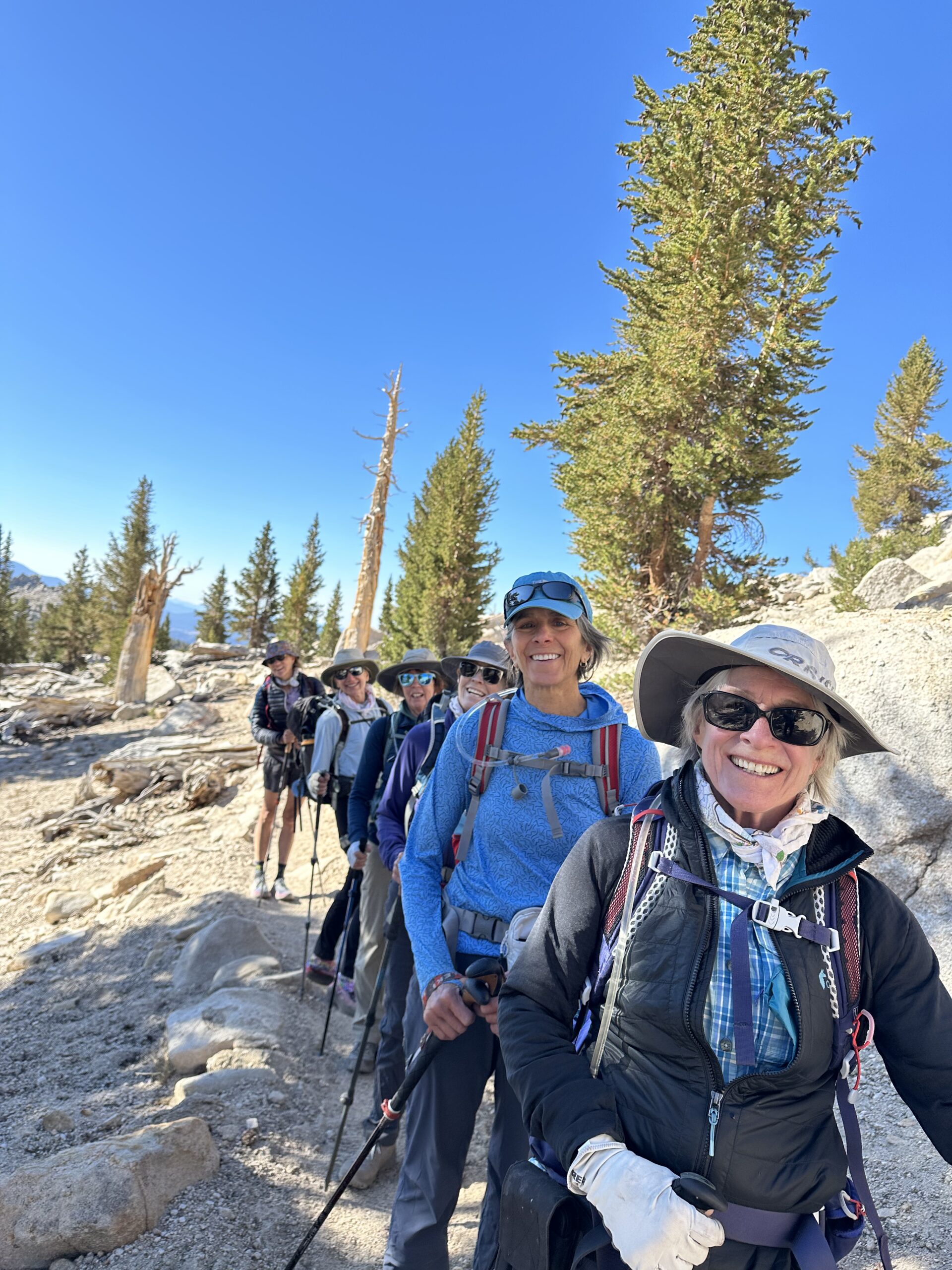
While anyone is welcome to join, this trip is intentionally designed for adventurous hikers aged 55 and over.
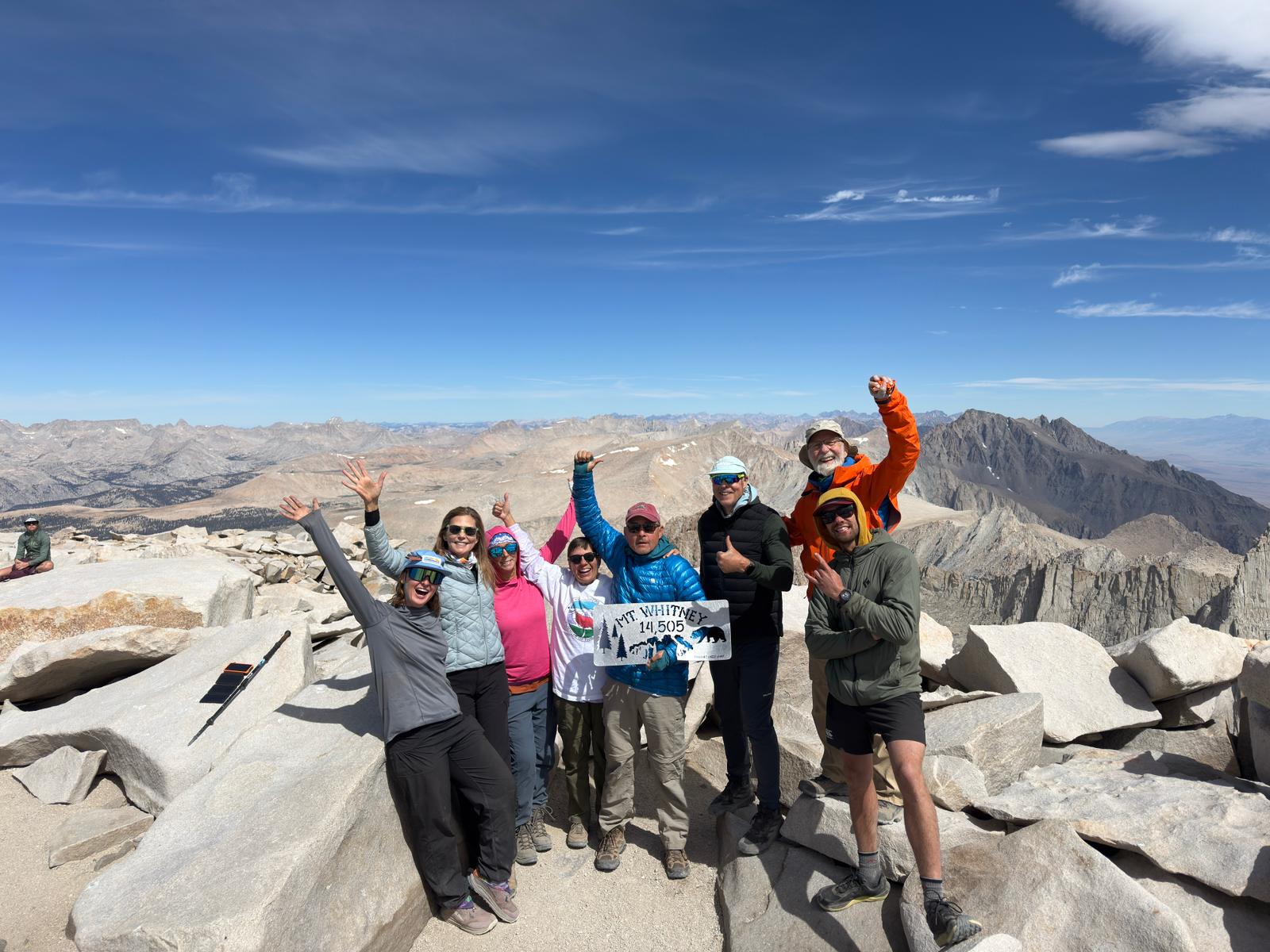
Mt. Whitney—standing at 14,505 feet—is the highest peak in the continental United States and the highlight of our mule-supported backpacking trips. This itinerary is the most comfortable way to hike Mt Whitney with mule support, making long days and significant mileage at altitude far more accessible and enjoyable.
Our route begins in Horseshoe Meadows, crosses the Sierra Crest at Cottonwood Pass, then drops west toward the Kern River before looping back east to Guitar Lake beneath Mt. Whitney’s western slopes. We love this route because:
- It’s stunning, with high alpine lakes, open basins, and expansive Sierra views. This is an incredible backpacking trip—Mt. Whitney’s summit is the reward at the end.
It sees far fewer people compared to the standard Whitney Trail.
Cottonwood Pack Station supports our group by carrying equipment, allowing you to hike with just a day pack.
What's Included in our Mt Whitney Hike?
- 18 meals (breakfast, lunch, and dinner for the entire trip) — healthy, hearty, and delicious
- Professional guides
- Full pack stock support from Cottonwood Pack Station
- All required permits
- Tents, kitchen gear, and group equipment
- Pre-trip support — our helpful office staff is here to assist you as you prepare and answer all your questions
Prerequisites
- Ability to hike up to 14 miles per day with a day pack
- Comfortable with 3,000+ feet of elevation gain in a day
- Prior experience hiking on rocky, uneven trails
- Understanding that while mules carry gear, daily mileage and elevation are still significant
Weight & Gear
At our trip orientation, you’ll receive a duffel bag for all the gear you want the mules to carry. Each participant may send up to 20 pounds of gear with the mules (this does not include your tent). We will weigh your duffel at orientation, and anything over 20 pounds will need to be carried in your own pack.
Your day pack will weigh about 15 pounds, including water, layers, snacks, and personal essentials.
Acclimatization & Physical Training
For proper acclimatization, we recommend spending at least one night at a moderate elevation (above 8,000 feet) before the trip begins. This allows your body to adjust to higher altitude and can help make hiking feel more comfortable.
See our Fitness, Training & Acclimatization Tips for detailed guidance on how to prepare.
Daily Mileage & Elevation
| Day | Destination | Mileage | Elevation Gain |
|---|---|---|---|
| Day 1 | Meet at trailhead campground for acclimatization night | 0 miles | 0' |
| Day 2 | Chicken Springs Lake | 5.3 miles | 1405' |
| Day 3 | Rock Creek Crossing | 10.5 miles | 620' |
| Day 4 | Guitar Lake | 10.3 miles | 2985' |
| Day 5 | Mount Whitney then back to Crabtree Meadows | 14.4 miles | 3405' |
| Day 6 | Rock Creek Lake | 11.3 miles | 2020' |
| Day 7 | Back to Trailhead | 11.4 miles | 1435' |
Next Steps
Ready to Join?
Click the “Book Now” button to secure your spot and start planning your trip.
Payment
A 50% deposit is due to book your trip. Final payment is due 90 days before your trip.
Have Questions?
We’re here to help! Fill out our Contact Form or give us a call at 760-873-8526, and our friendly team will assist you.
Day 1 – Acclimatization Day
We meet for a trip orientation at 5.00 p.m. at the Cottonwood Campground, set up tents and have dinner before settling in for the night.
Day 2 – The Journey Begins
We get our equipment sorted and to the packers before hiking from the Cottonwood Pack station up and over Cottonwood Pass and descend a little over about a half mile to Chicken Springs Lake, our first night’s camp. This day is about 5 miles long with about 1400 feet of elevation gain and makes for a great break-in day further improving your acclimatization to the elevation. There will be plenty of time in camp to relax and enjoy the surroundings.
Day 3 - Acclimatization Day – Enter Sequoia Kings National Park
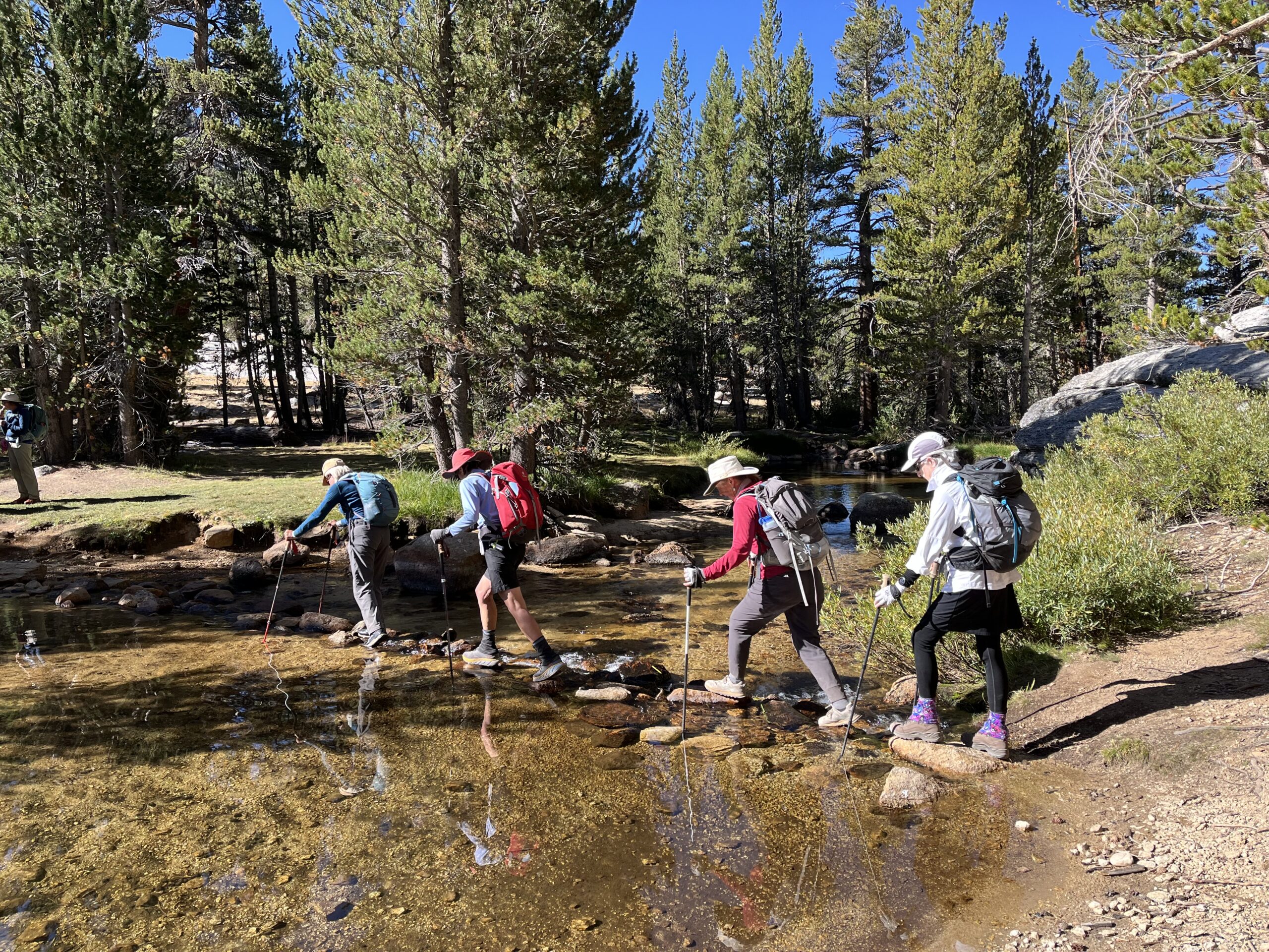
We leave camp and, after a short initial climb, much of the day is relatively flat or downhill. We contour above Big Whitney Meadow with views towards the Kaweah’s. After entering Sequoia Kings National Park, we continue to the lower crossing of Rock Creek. This is about a 10 mile day.
Day 4 – Getting Ready for Whitney
Our day starts with a climb over Guyot Pass and into the wide open spaces of Guyot Flat. Staying near treeline, we climb and contour around into Crabtree Meadows. We now turn towards Mt. Whitney and steadily climb to camp overlooking Guitar Lake (11,460’). The pack stock leave us here and return to Crabtree Meadows to overnight the mules.
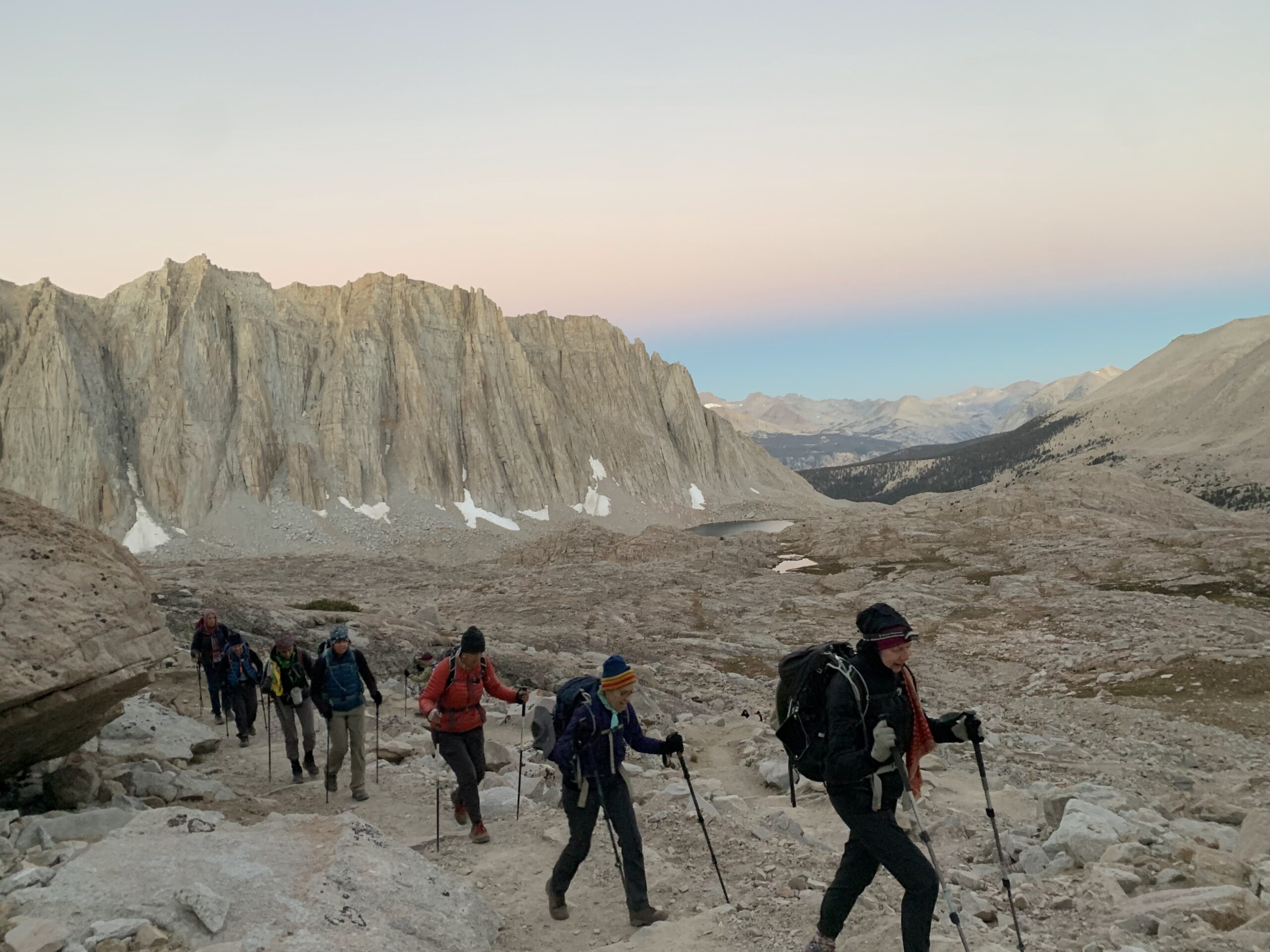
Day 5 – Summit Day!
We are not too far from the summit but we allow all day for the ascent to the summit and the return to a lower camp. There are numerous switchbacks up to Trailcrest (13,550’) where we meet others coming up from the other side. The summit seems within grasp but the thin air limits our ability to move speedily, though with slow but steadily progress before long we will be on top and enjoying the highest point outside of Alaska. After summit photos and relaxing on top we retrace our steps back. While we are climbing the packers come up and collect our camp and move it down to Crabtree Meadow. Doing it this way sets the stage for an easier last day back to the cars.
Day 6 – Return to Rock Creek
The packstock return and pick up our gear and we retrace our steps back to Rock Creek Crossing and then head to camp at Rock Creek Lake via a different route.
Day 7 – Return to the Trailhead
Back to the road head. This is a long day so be prepared for an early start and a late afternoon return to the trailhead.
Links
Rental Equipment
We have rental equipment available at checkout.
Reviews
Jim, Evolution Loop Mule Supported 2025
“I had high expectations since I did the Mammoth to Yosemite mule trip last year, and enjoyed it so much that I wanted to do another trip this year. This trip did meet my expectations. It was just as good as last year, though very different–much bigger group, two guides, two packers and very different scenery. I especially enjoyed all of the water–streams, lakes, waterfalls–this year…Both guides were great and worked together really well to get everything done in an efficient manner. Larry was our guide last year and was one of the main reasons that I wanted to do another trip–an amazing guide. Krystina was also excellent. Both were extremely well organized, very concerned about safety and protecting the environment, great communicators, and fun to hike with. Packers and mule support were great as well. And–food was excellent, same as last year.
Betsy, Mule Supported Mt. Whitney
“I can’t say enough great things about the Sierra Mountain Center’s 7-day Pack Supported Women’s Whitney Trip. Our guides and packers were professional and on top of every detail. The guides especially were knowledgeable, experienced and fun to be around. They made all 10 of us feel supported on our quest for Mt. Whitney. The food was nutritious and delicious and our campsites were private and spacious. All in all, a wonderful way to experience the Sierra!”
More Reviews
Karen, Mule Supported Mt. Whitney
“This is a top notch outfitter. For a week-long, mule-supported trip for 9 women that included summiting Mt. Whitney, our guides were excellent: knowledgeable, experienced, patient, kind, excellent cooks, skilled communicators and planners. As for Sierra Mountain Center, they represented the trip accurately, gave detailed advice on what to bring and how to prepare for the trip, designed a comfortable itinerary that we all could complete, provided excellent tents. The mule support was executed seamlessly, as we always had our gear, transported carefully and delivered in fine form when we arrived at our next camp. I highly recommend this outfitter/guiding service.”
Jennifer, Mammoth to Yosemite Mule Supported
“I had the most amazing experience with Sierra Mountain Center on a mule supported section hike on the John Muir Trail from Red’s Meadow to Yosemite Valley in July 2022. Everything about this trip was fantastic! Emma was wonderful helping set up the trip and answer all of my questions beforehand. Our guide, Larry, was simply the best! He is extremely knowledgeable about backpacking and the surrounding area, and his enthusiasm is contagious. He was as excited as we were to be on the trip, and he was great at anticipating when we might need a break and motivating us to push through the hills. This was my first backpacking trip, so I really appreciated his guidance and encouragement, not to mention his great cooking skills in the back country! I loved that this trip was supported by mules, and our cowboy, Tom, was fantastic as well. The mules helped carry the bulk of our gear, so we only carried a daypack of belongings and snacks, allowing us to fully appreciate the long hikes. The camp spots were beautiful and this section of the JMT is incredible, and I am now looking forward to joining other SMC trips in the future.”
Beth, Mule Supported Mt. Whitney
“Best ever trip in the Sierra! I would highly recommend the Women’s Whitney trip with Sierrs Mountain Center. Everything was ideal. The guides (Heather and Madeline) were the very best–so knowledgeable and supportive of our goals.
Thanks so much!!”
Jessica, Mule Supported Mt. Whitney
“BIG GIANT THANKS to Tyler & Dave for guiding us on an EPIC 7-day adventure through the Sierras and helping us all summit Mount Whitney 🙂 What an incredible playground full of ancient trees, luscious valleys, streams and natures best COLD plunge lakes! It literally was something I dreamed of for the past 20 years and sharing this journey with my teenage boys was a memory I will never forget. You truly spoiled us with all your backpacking & cheffing skills 🙂 Thank you for sharing your passion, wisdom, humor and patience. WE all learned so much and can’t wait for the next one!”
Related Trips
- $4,945.00
- 9 Days
- Check back for future dates or contact us to inquire about a private trip!
- $3,995.00
- 7 Days
- August 3-9, 2026 (2 spots left)
- August 3-9, 2027
- $4,945.00
- 8 Days
- August 14-21, 2026 (1 spot left)
- August 23-30, 2027
2026 Dates
2027 Dates
- August 3-9, 2026 (2 spots left)
- August 3-9, 2027