Home / All Programs / Backpacking & Hiking / Mt. Langley
Mt. Langley
$895

- Custom trips at any time, contact us!
Trip Overview: Mt. Langley Backpacking Trip
Mount Langley, at 14,042 feet, is the southernmost of California’s fourteen-thousand-foot peaks. On our Mt Langley backpacking trip, you’ll reach a beautiful summit without needing technical climbing experience. The guided climb is straightforward, gaining most of the elevation on a well-maintained trail before a short talus scramble to the top.
Langley has a colorful climbing history. Its proximity to nearby Mount Whitney caused early confusion among mountaineers. The redoubtable Clarence King made what was likely the second ascent in 1871, mistakenly believing he had summited Whitney during poor visibility. By the time he returned from the East Coast to correct the record, a group of Lone Pine fishermen had already reached the true high point of the lower 48. Learn more about Mount Langley’s history and geology.
Acclimatization & Physcial Training
Because of the high elevation of Mt. Langley, proper acclimatization is essential. It’s easy to ascend too quickly without giving your body time to adjust. The trailhead is at about 10,000 feet—one of the highest trailheads in the Sierra Nevada—so we recommend spending at least one night at a moderate elevation (above 8,000 feet) before the trip begins. This helps your body adapt and makes hiking more comfortable and enjoyable.
See our Fitness, Training & Acclimatization Tips for detailed guidance on how to prepare.
Inclusions
- 7 meals (breakfast, lunch & dinner for the entire trip): Our meals are healthy, made with high-quality dehydrated ingredients, and prepared by your guide before the trip.
- Guides
- Permits
- Tents, kitchen gear & other group gear
Prerequisites
- No prior backpacking experience required, but prior day hiking experience is required
- Good physical condition and comfort hiking up to 6 miles with 3,000 ft of elevation gain per day
- Ability to carry a 35-45 pound backpack
Meeting Location
We’ll meet in Lone Pine for our gear check and trip orientation. Meeting here makes it easy to pick up any last-minute items from nearby stores before heading to the trailhead. We’ll be in touch with detailed meeting instructions and logistics after you register for the trip.
Next Steps
Ready to Join?
Click the “Book Now” button to secure your spot and start planning your trip.
Payment
A 50% deposit is due to book your trip. Final payment is due 30 days before your trip.
Have Questions?
We’re here to help! Fill out our Contact Form or give us a call at 760-873-8526, and our friendly team will assist you.
Day 1 – Hike to Cottonwood Basin Camp
We’ll meet in Lone Pine for a gear check before caravanning to the Cottonwood Lakes Trailhead. Our trailhead is one of the highest in the Sierra Nevada at over 10,000 feet. From here, the trail climbs steadily—but not steeply—through pine forest and meadows toward our camp in the Cottonwood Basin. The scenery is classic High Sierra, with granite peaks, alpine lakes, and broad open meadows surrounded by rugged summits.
Starting elevation: 10,000 ft
Ending elevation: 11,300 ft
Distance: 5.5 miles with 1,350 ft gain and 300 ft loss
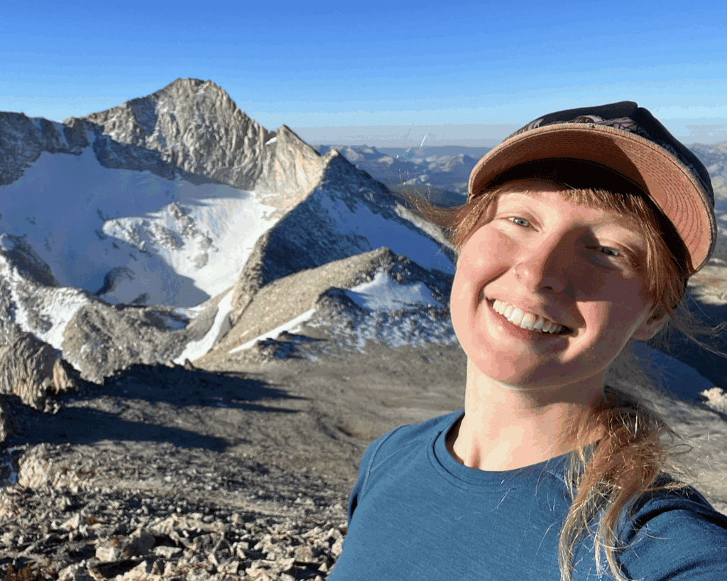
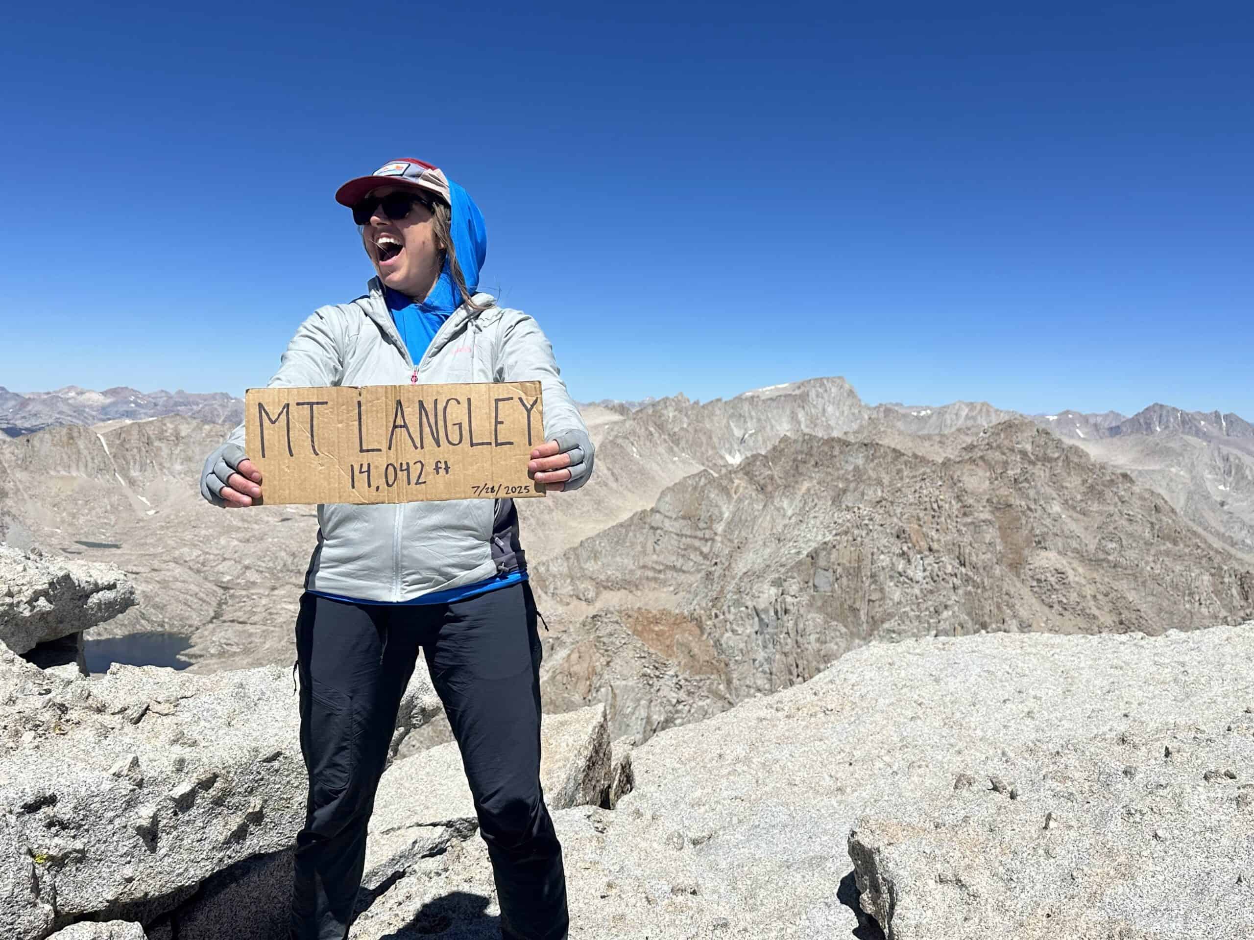
Day 2 – Summit Mt. Langley
We’ll start early for our Mount Langley ascent, crossing either Old Army Pass or New Army Pass depending on snow conditions. Once atop the crest, we travel cross-country across a high alpine plateau with sparse vegetation and sweeping views. The final 500 feet to the summit involve easy Class 2 scrambling—using hands for balance over large rock blocks—to reach the broad summit plateau. From the top, we enjoy stunning views of Mount Whitney, Lone Pine Peak, and the heart of the Sierra Nevada. We’ll return to camp and spend a final night by the lake.
Starting elevation: 11,300 ft
Summit elevation: 14,042 ft
Distance: 4.0 miles with 3,100 ft gain and 207 ft loss
Day 3 – Return to the Trailhead
After a relaxed breakfast and sunrise over the Cottonwood Basin, we’ll pack up camp and retrace our route down to Horseshoe Meadows, returning by early afternoon.
Starting elevation: 11,300 ft
Ending elevation: 10,000 ft
Distance: 5.5 miles with 300 ft gain and 1,350 ft loss
Rental Equipment
We have rental equipment available at checkout.
Reviews
Durs, John Muir Trail 2025
“The trip exceeded my expectations in that everything and everyone was perfect. The support during the trip and the support given to the guides was excellent…Madeline and Kanyon gave exceptional personal service for 26 days! That is extremely hard to do. They cooked us wonderful breakfast, lunch and dinners for 25 days and satisfied all of us hikers…The best thing I can say about them is that both are the most capable outdoor experts I know (Dave is in this group too). I can’t think of any negatives to the greatest service they provided.”
Becky, Sky Marathon 2025
“Your service exceeded my expectations. This was my first backpacking trip and I felt well prepared in large part to your online resources (training plan, equipment list, route description). Heather was awesome – set a careful pace and was patient and personable…She kept us safe with tips and reminders throughout the trip. I appreciated her reviewing our equipment before we left and teaching me how to pack my bag and set up a tent.”
Paul, Evolution Loop Backpacking Trip
“I went on the 6-day Evolution Loop backpacking trip. I had the time of my life. The scenery was stunningly beautiful. Our guides kept us safe, prepared excellent meals, and were very knowledgeable about the area. They were friendly and kept us informed about what to expect each day. I only wish the trip lasted more days. I’ll be back for more.”
More Reviews
Brecken, Women’s Beginning Backpacking
“This service is great! I talked at length prior to the trip with the office staff on several different occasions. They answered all my questions and made me feel comfortable with the decision to take the trip. They were always so happy to chat at length. It was easy to book and the service was perfect!”
Ken, John Muir Trail
“SMC and it’s staff were completely responsible for making my JMT trip such a wonderful experience. Very competent and helped me prepare for the journey from their wealth of experience and expertise! Highly recommend this company to anyone looking for an adventure in the Sierra!”
Collette, Death Valley Backpacking
“Death Valley backpack with SMC guide Larry Gumina was exceptional!! He made awesome dinners and guided through exciting conditions (running creeks!). What a trip!!”