Home / All Programs / Backpacking & Hiking / Mammoth to Yosemite Valley Hike
Mammoth to Yosemite Valley Hike
$1,645


2026 Dates
- July 16-21 | August 6-11 | August 20-25


Trip Overview: Mammoth to Yosemite Guided Hike
This six-day Mammoth to Yosemite hike follows one of the most scenic sections of the John Muir Trail, showcasing everything the Sierra Nevada is known for—wide river valleys, alpine lakes, high passes, and dramatic granite peaks.
We begin in Mammoth Lakes, where you can spend the night before the trip and start acclimating to the elevation. Each day, we plan to arrive at camp by early afternoon, leaving time to relax by a lake, fish, read, or take a short hike without your overnight pack.
What's Included
- 16 meals (breakfast, lunch & dinner for the entire trip): Our meals are healthy, made with high-quality dehydrated ingredients, and prepared by your guide before the trip.
- Shuttles
- 1 resupply
- Guides
- Permits
- Tents, kitchen gear & other group gear
Meeting Location
We’ll meet at the Mammoth Lakes Welcome Center in town for our gear check and trip orientation. Meeting here makes it easy to pick up any last-minute items from nearby stores before heading to the trailhead. We’ll be in touch with detailed meeting instructions and logistics after you register for the trip.
Shuttle
We’ll leave vehicles at the Mammoth Mountain Main Lodge for the duration of the trip. At the end of the journey, we’ll take the YARTS shuttle from Yosemite Valley back to Mammoth Lakes. Sierra Mountain Center will organize all shuttles and logistics for you—no need to worry about transportation details.
Resupply
We’ll meet you in Tuolumne Meadows on Day 4 for a mid-trip resupply, so you’ll only need to carry about three and a half days’ worth of food from the start. This keeps your pack lighter and makes the hike more enjoyable.
Preprequisites
- No prior backpacking experience required
- Good physical condition and comfort hiking up to 14 miles per day
- Ability to carry a 35-45 pound backpack
Acclimatization & Physical Training
For proper acclimatization, we recommend spending at least one night at a moderate elevation (above 8,000 feet) before the trip begins. This allows your body to adjust to higher altitude and can help make hiking feel more comfortable.
See our Fitness, Training & Acclimatization Tips for detailed guidance on how to prepare.
Short on Time?
Our four-day Mammoth to Tuolumne Guided Hike follows this same route, but ends on day four in Tuolumne Meadows—perfect for hikers who want a classic Sierra experience in less time.
Next Steps
Ready to Join?
Click the “Book Now” button to secure your spot and start planning your trip.
Payment
A 50% deposit is due to book your trip. Final payment is due 30 days before your trip.
Have Questions?
We’re here to help! Fill out our Contact Form or give us a call at 760-873-8526, and our friendly team will assist you.
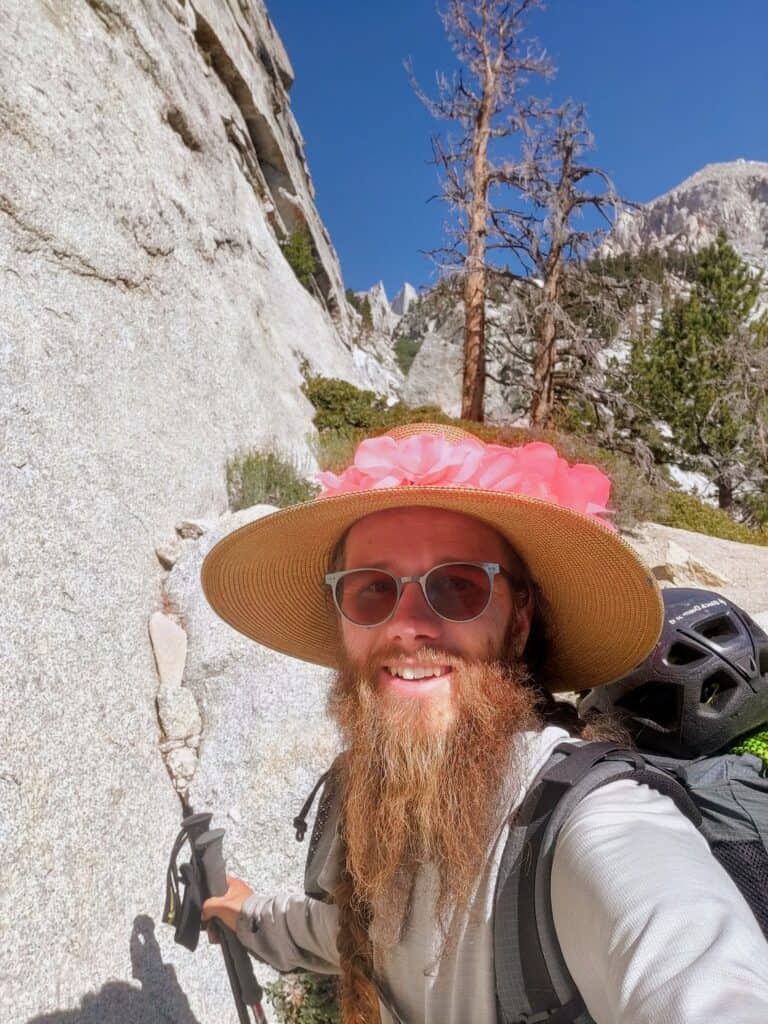
Day 1 – Mammoth Lakes to Shadow Creek
We’ll meet in Mammoth Lakes for a quick gear review before heading to the Agnew Meadows trailhead. From there, we follow the River Trail upstream along the rushing San Joaquin River. After passing Olaine Lake, the trail climbs toward Shadow Lake, offering fantastic views of the jagged Minarets and the rugged summits of Mount Ritter and Banner Peak.
We’ll make camp above Shadow Lake near Shadow Creek, keeping this first day moderate to ease into the journey.
Starting elevation: 8,314 ft
Ending elevation: 9,000 ft
Distance: 4.5 miles with 1,100 ft gain and 420 ft loss
Day 2 – Shadow Creek to Rush Creek
We head north, paralleling the San Joaquin River and passing some of the Sierra’s most beautiful alpine lakes—Ruby, Garnet, Emerald, and finally the incomparable Thousand Island Lake. We’ll take our time here, wandering along the shoreline and soaking in the views before climbing gently over the low and easy Island Pass.
From there, we descend into the Rush Creek drainage and make camp near the forks of the creek.
Starting elevation: 9,000 ft
Ending elevation: 9,650 ft
Distance: 8.0 miles with 2,000 ft gain and 1,500 ft loss
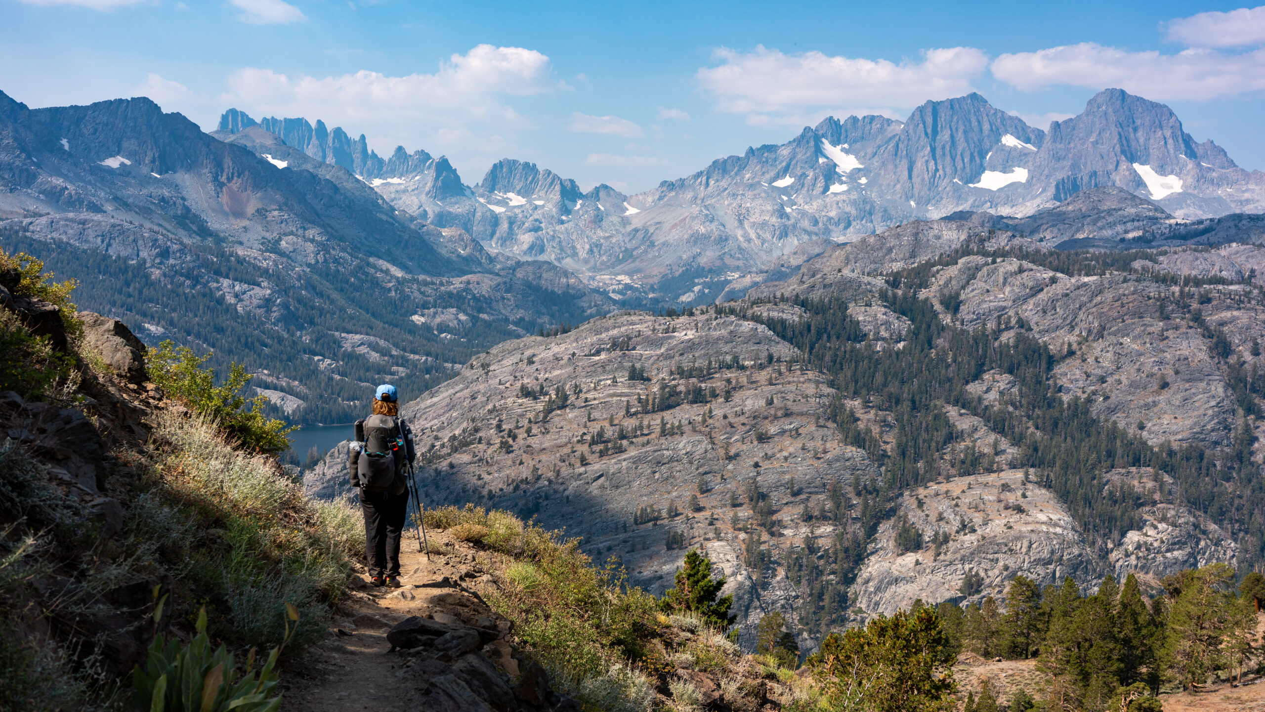
Day 3 – Rush Creek to Lyell Canyon
Today brings our highest pass of the trip, but the climb is steady and manageable. We shoulder our now lighter packs and ascend to Donohue Pass, crossing from the Ansel Adams Wilderness into Yosemite National Park.
From the top, we enjoy sweeping views of the Sierra before descending into Lyell Canyon, with Mt. Lyell—the park’s highest peak—towering above. We continue down into the wide, glacially carved valley and make camp near the Tuolumne River at the base of the canyon.
Starting elevation: 9,650 ft
Ending elevation: 8,950 ft
Distance: 8.0 miles with 1,500 ft gain and 2,200 ft loss
Day 4 – Lyell Canyon to Cathedral Lakes
It’s all downhill at first as we follow the Lyell Fork of the Tuolumne River through the broad, grassy expanse of Lyell Canyon. The river meanders lazily toward Tuolumne Meadows, where we’ll stop to pick up our food resupply and enjoy a well-earned break.
From Tuolumne Meadows, we continue along the John Muir Trail, climbing gradually to camp near the peaceful shores of Cathedral Lakes—one of the most beautiful spots in Yosemite.
Starting elevation: 8,950 ft
Ending elevation: 9,600 ft
Distance: 13.75 miles with 1,600 ft gain and 1,000 ft loss
Day 5 – Cathedral Lakes to Sunrise Creek
From Cathedral Lakes, we continue south along the John Muir Trail, passing the Sunrise High Sierra Camp with its sweeping views of the Yosemite backcountry. From here, the trail descends steadily toward our final camp, nestled among the trees near Sunrise Creek.
Starting elevation: 9,600 ft
Ending elevation: 7,175 ft
Distance: 10.5 miles with 850 ft gain and 3,300 ft loss
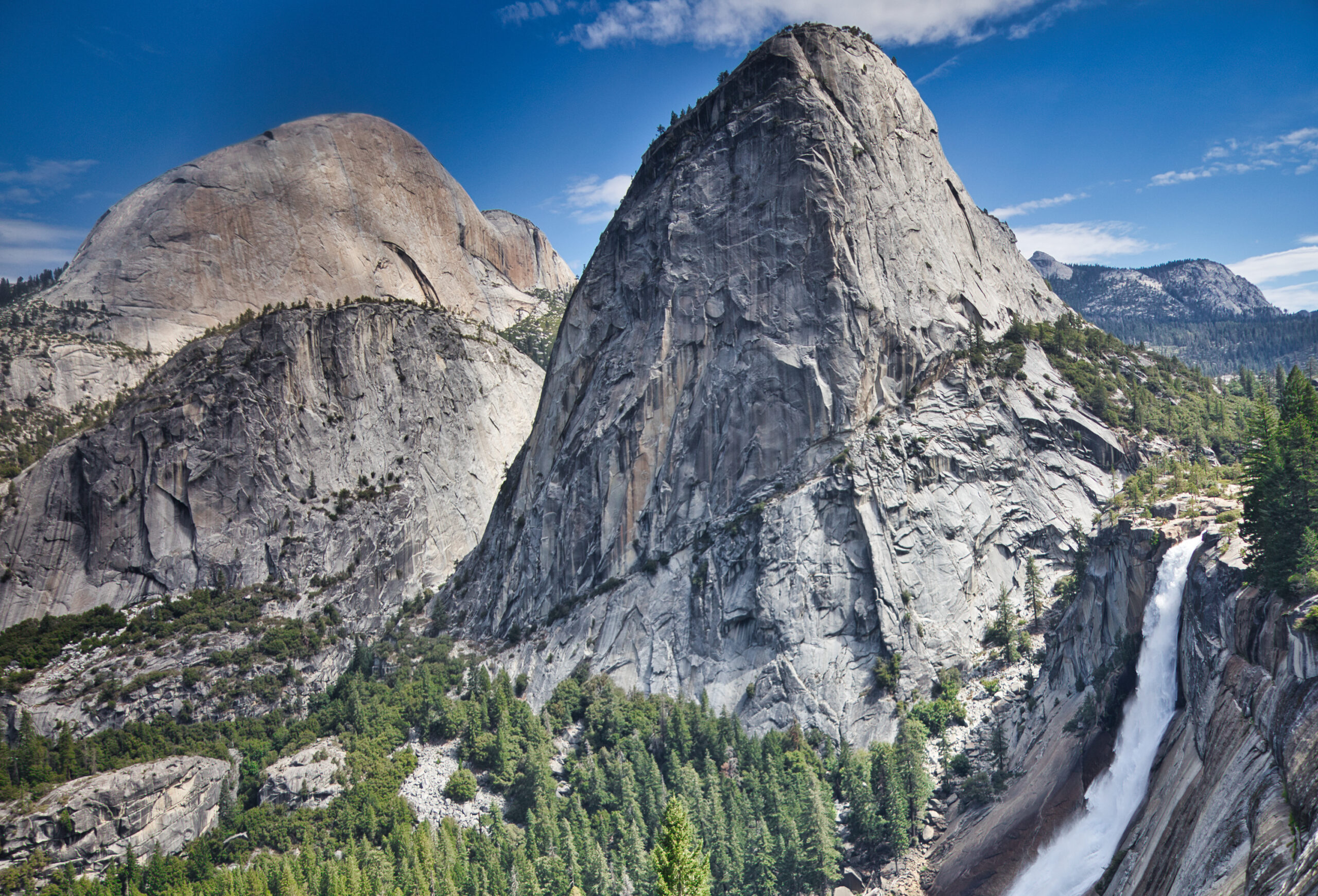
Day 6 – Sunrise Creek to Yosemite Valley
On our final day, we start early to beat the heat and begin the long descent into Yosemite Valley. The trail follows the iconic Mist Trail, passing the Emerald Pool, Vernal Fall, and Nevada Fall before reaching the bustle of Happy Isles and our pickup point at Curry Village.
After a quick stop at the market and store, we’ll take the three-hour shuttle ride back to Mammoth Lakes for some well-earned rest and celebration.
Starting elevation: 7,175 ft
Ending elevation: 4,000 ft
Distance: 6.8 miles with 220 ft gain and 3,400 ft loss
Rental Equipment
We have rental equipment available at checkout.
Reviews
Durs, John Muir Trail 2025
“The trip exceeded my expectations in that everything and everyone was perfect. The support during the trip and the support given to the guides was excellent…Madeline and Kanyon gave exceptional personal service for 26 days! That is extremely hard to do. They cooked us wonderful breakfast, lunch and dinners for 25 days and satisfied all of us hikers…The best thing I can say about them is that both are the most capable outdoor experts I know (Dave is in this group too). I can’t think of any negatives to the greatest service they provided.”
Becky, Sky Marathon 2025
“Your service exceeded my expectations. This was my first backpacking trip and I felt well prepared in large part to your online resources (training plan, equipment list, route description). Heather was awesome – set a careful pace and was patient and personable…She kept us safe with tips and reminders throughout the trip. I appreciated her reviewing our equipment before we left and teaching me how to pack my bag and set up a tent.”
Paul, Evolution Loop Backpacking Trip
“I went on the 6-day Evolution Loop backpacking trip. I had the time of my life. The scenery was stunningly beautiful. Our guides kept us safe, prepared excellent meals, and were very knowledgeable about the area. They were friendly and kept us informed about what to expect each day. I only wish the trip lasted more days. I’ll be back for more.”
More Reviews
Brecken, Women’s Beginning Backpacking
“This service is great! I talked at length prior to the trip with the office staff on several different occasions. They answered all my questions and made me feel comfortable with the decision to take the trip. They were always so happy to chat at length. It was easy to book and the service was perfect!”
Ken, John Muir Trail
“SMC and it’s staff were completely responsible for making my JMT trip such a wonderful experience. Very competent and helped me prepare for the journey from their wealth of experience and expertise! Highly recommend this company to anyone looking for an adventure in the Sierra!”
Collette, Death Valley Backpacking
“Death Valley backpack with SMC guide Larry Gumina was exceptional!! He made awesome dinners and guided through exciting conditions (running creeks!). What a trip!!”